Carrauntoohil
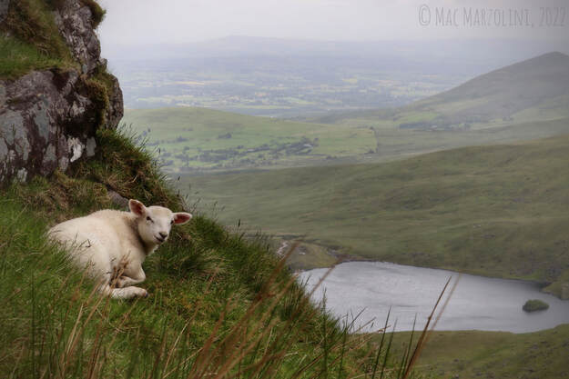
A Young Lamb From the Devil's Ladder
At 1,038 metres, Carrauntoohil is Ireland's highest peak, both in terms of height and prominence, how high it sticks out of the immediate area. The mountain is situated in the middle of the MacGillycuddy's reeks, also spelt McGillicuddy's reeks, a mountain range carved by glaciers during the last ice age. The ice carved deep valleys and exposed large outcrops of bedrock. This rock is largely composed of old red sandstone, oxidization has caused much of the rocks to appear purple, especially with the cloud's misty touch. As my old friend Sandeep and I leave our cab we are soon greeted with what seems like an out of place pop-up café, the Carrauntoohil Coffee Hut. The individual running it, a man dressed as though working at a high end bar in the middle of a financial district, but here he is in the absolute middle of nowhere selling coffee in an empty parking lot. A few metres away was the gate to the property, Carrauntoohil sits on private property and is used as a large pasture though recreational hiking is permitted. The gate in question was a kissing gate, a device Sandeep had clearly never seen before as he decided to climb right over it. I was watching bewildered, as was the cab driver and likely the chap selling coffee as well. I then promptly walked through, in the regular fashion, perhaps making Sandeep feel self conscious about the ordeal.
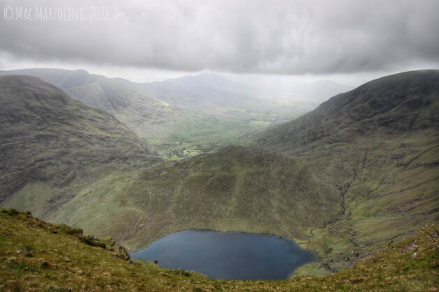
The MacGillicuddy's Reeks
The walk to the ascent was peaceful, we saw the mountians looming overhead though due to bad weather (which we jokingly just called "Irish"), we were unable to see the top of Carrauntoohil and had to speculate which mountain we were looking at which based on our map. The walk through Hags Glen was peaceful, offering views of valleys, some goats, and nice little birding opportunity. Though I was more a birder than my hiking companion, I still managed to see some ravens, meadow pipits and got my lifer northern wheatear, a species that can also be found back home in Canada.
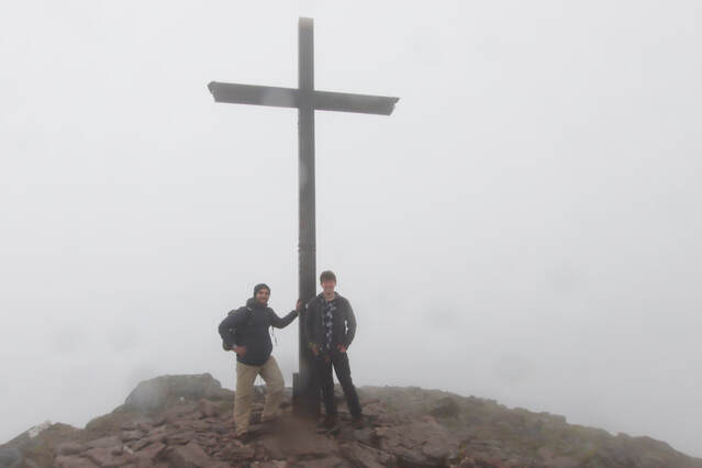
An Iron Cross Marks Carrauntoohil's Peak
Often called the “tourist route” we make our ascent up the devil’s ladder, a precarious climb with loose rocks and running water that seeps from the mountain’s soil, rendering the mossy boulders a slippery mess. During this, I’m reminded of one gentleman who’s lifeless body was recovered no more than a week prior to our climb. Holding a bag of chips in one hand and stone with the other, we manoeuvre ourselves to the ridge between Cnoc Toinne and Carrauntoohil itself. There, we can see for miles, a landscape of grass and stone, as if from a book of fantasy with Lough Callee‘s water dancing in the wind. Upon our ascent of Carrauntoohil, a gentleman coming down smiled when telling us “if it’s any consolation lads, you’re nowhere near the top”. Luckily, the mountain itself was a peaceful stroll, a clear path winding up the mountain. Soon the strong winds pulled a vail of clouds over Caher like a waterfall of mist. It soon shrouded the sky above and the land below. Only the immediate trail was visible as was the large boulders and sheep that seemed more at home here than us. Through the mist, we could soon make out the large cross, marking the peak, almost symbolic if either of us subscribed to such things. While most took the peak as an opportunity to sit down and rest, the peak was filled with too much wildlife to simply sit in one place. Large black slugs could be found throughout the many rocks, some feeding on food left from previous hikers, and a meadow pipit that was remarkably tame and rather photogenic in the mist. After having lunch, we made our way back down before taking the remarkably windy Cnoc Toinne and the zigzag trail back to Hags Glen.
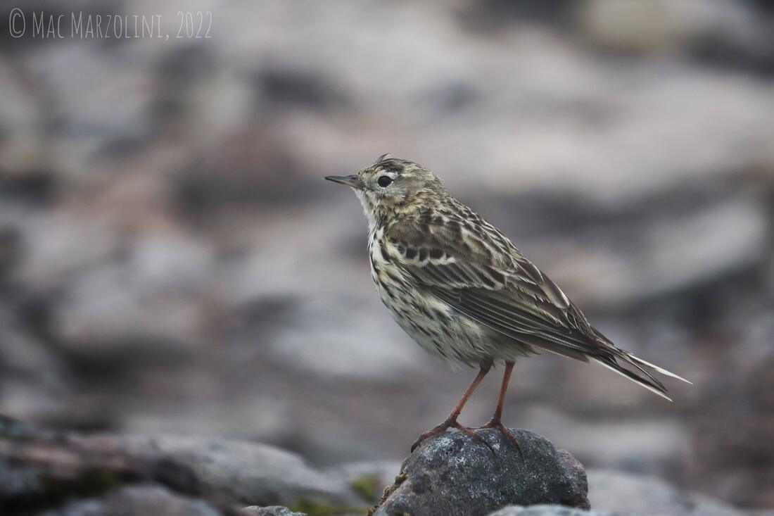
Meadow Pipit on the Peak of Carrauntoohil
Cnoc Toinne was a large grassy peak adjacent to Carrauntoohil, fewer sheep but it offered some lovely views through the mist. From there was the zigzag, a trail that aptly zigzags down the side of the mountain. The trail itself was thin with a shear drop only inches from each step. The hike itself was not an issue but the wind causing myself to lose balance proved an issue. Also coming down the zigzag were two other hikers of similar ages to ourselves, neither had climbed the mountain before and did not know the way back. For some reason (which I later learned to be my charismatic swagger) they appeared under the impression that I knew the way back to the main trail to Hags Glen. The trail at this part was not well marked and I may have been going ever so slightly the wrong way, as did the two hikers who were following us. It soon became clear that I was not going the correct way and I noticed them look at each other before changing direction. Overall a lovely hike which earned a pint or two at O'Connor's later that evening.
